This and That Newsletter
Vol 13 Issue 632 Circulation 5,000 March 5, 2009
PO Box 11
Ardmore, Oklahoma 73402
email address: butchbridges@oklahomahistory.net
580-657-8616 (not a toll free number)
From The Wilson Post, September 27, 1962
Wilson, Oklahoma by Robert S. Davie
Indian Trails, Wagon Roads No More. There were a few thorns among the roses in the old days, perhaps the stickiest were the roads. Some roads had more than one set of ruts and when the driver of a "puddle-jumper" made his choice, he'd had it. Road information meant road information, not route information. Road signs were few and far between and obscured with clouds of dust or high weeds. Unexpected wash-out and bridge-out barriers challenged the temper of the driver, his mechanical brakes, and reverse gear. Most roads followed the 1895 land survey lines, and road turns generally formed a sudden but true right angle. An exception to this rule was bridge crossings where roads jagged and sagged. Many bridges were anchored by cable to a nearby tree to retrieve the bridge timbers after flood waters.
About 1928 car ads in the Herald Herald stated new models would go a mile a minute- 60 m.p.h! Seldom did a Healdton car dealer drive to the Lawton highway to prove it, and no one in his right mind would try to prove it nearer to Healdton.
Driver courtesy on early paved highways was a must, since all paved roads were narrow and some would accommodate only one-way travel. The curves were consistently banked to the wrong side of the road in one man's most daring efforts to defy the laws of inertia.
When it rained around Healdton in the 30's you could bury C. N. Strong's hunting dog, Fripo, in any section line road without a grubbing hoe. The law required rural residents to pay an annual road tax of ten dollars or furnish an able-bodied person for three days "working the roads". Boys were not especially thrilled to receive a notice each spring to report to Mr. Olle Keck for road work on three successive Saturdays. A weather beaten Stetson hid the twinkle in Mr. Keck's eye as he carefully halted his team to pick up a glum faced boy. His handsome span of horses pulled a wagon of unbelievable capacity. The crew, usually of four boys, included Horace Cooper, Loran Atteberry, Calvin Sewell, Odell Thompson, and at various times a number of others. The crew shoveled oil-soaked dirt hauled by wagon from tank batteries and filled mud holes on section line roads between Wirt and Healdton.
In this period, Walter and Tom, sons of Dan Blackburn, Healdton contractor, operated early model bulldozers at Murray Lake on highway construction. County graders were pulled by caterpillars or multiple teams. Movement of heavy loads and thin road beds, if any, made road grading a hoped-for event.
Early Roads Recalled. No tale of old roads around Healdton could properly end without mention of wagon routes and Indian trails. Indian Territory's first wagon routes, like the ancient roads of Rome, were built for military use. For sixteen years, General Matthew Arbuckle, Commandant at Fort Smith, sought authority to survey an army wagon route westerly to and beyond the Washita River. Finally in 1849 he was permitted to send Captain R. B. March and Lieut. Simpson, with 80 soldiers to survey a wagon route along and south of the Canadian River to Santa Fe, New Mexico. (Terr. Papers of U.S.; Vol XXI) An earlier Fort Smith road was to Fort Towson and Doaksville. The Butterfield Stage did not open Boggy Depot, south of Atoka, until 1858, running from Tipton, Missouri to California through north central and west Texas. The old Camp Holmes (Lexington) Road from Fort Smith was north of the Canadian.
Less than 30 miles west of Healdton, I.T. in the 1880s the old Chisholm cattle trail crossed "the Grand Prairie" of Indian Territory from Texas to Kansas. It created serious problems, especially for Pickens County Sheriff, Grove E. Chase of Healdton, I.T., father of Abel D. Chase, (Owen's 1887 Rpt) but this, like the Gainesville, Oklahoma and Gulf Railroad (27 Stat, 465), once charted and routed to pass through Healdton about Buttermilk, Kansas is another story.
Indian Bayou Trail. The historic Santa Fe Trail routed in the 1820s from Independence, MO crossed only the northwest corner of present Oklahoma Panhandle.
Near northeast Healdton, a principal Indian trail, perhaps as old as any of the upper Red River valley, crossed the Bayou. On a pre-Civil War map it is shown as "Cloud Road." (Marcy's Route, 1851). This trail extended from the mouth of Mud Creek on the "river Rouge", later "Rio Roho" and lately called Red River, northward beyond Wild Horse Creek. Another early map shows "Warren's T. H." (Trading House) in the vicinity of Rubottom near its beginning. This trail is plotted as bending northward along the east bank of Mud Creek to due north into old Healdton, then along the east side of the Arbuckle Mountains to about present Hennipin, Oklahoma.
The endless struggles over old Indian trails, wagon roads or even the mud ruts of the near past have gone before and are no more. Modern travel, like time, flies, but modern highways, like ancient Rome are not built in one day.
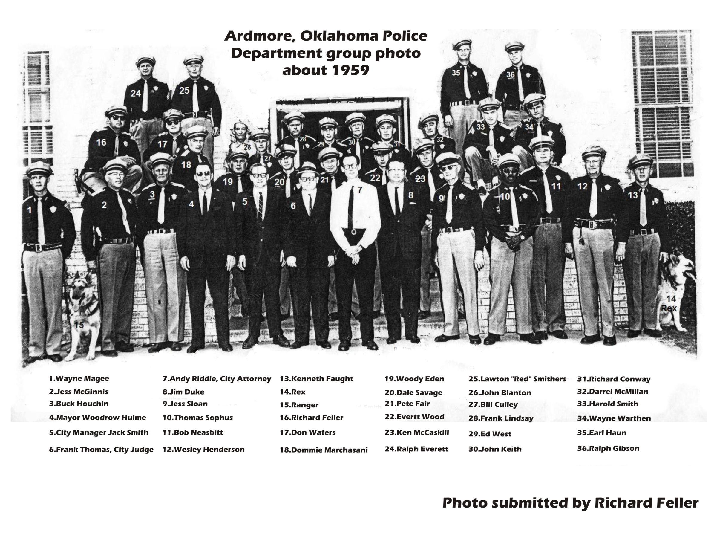
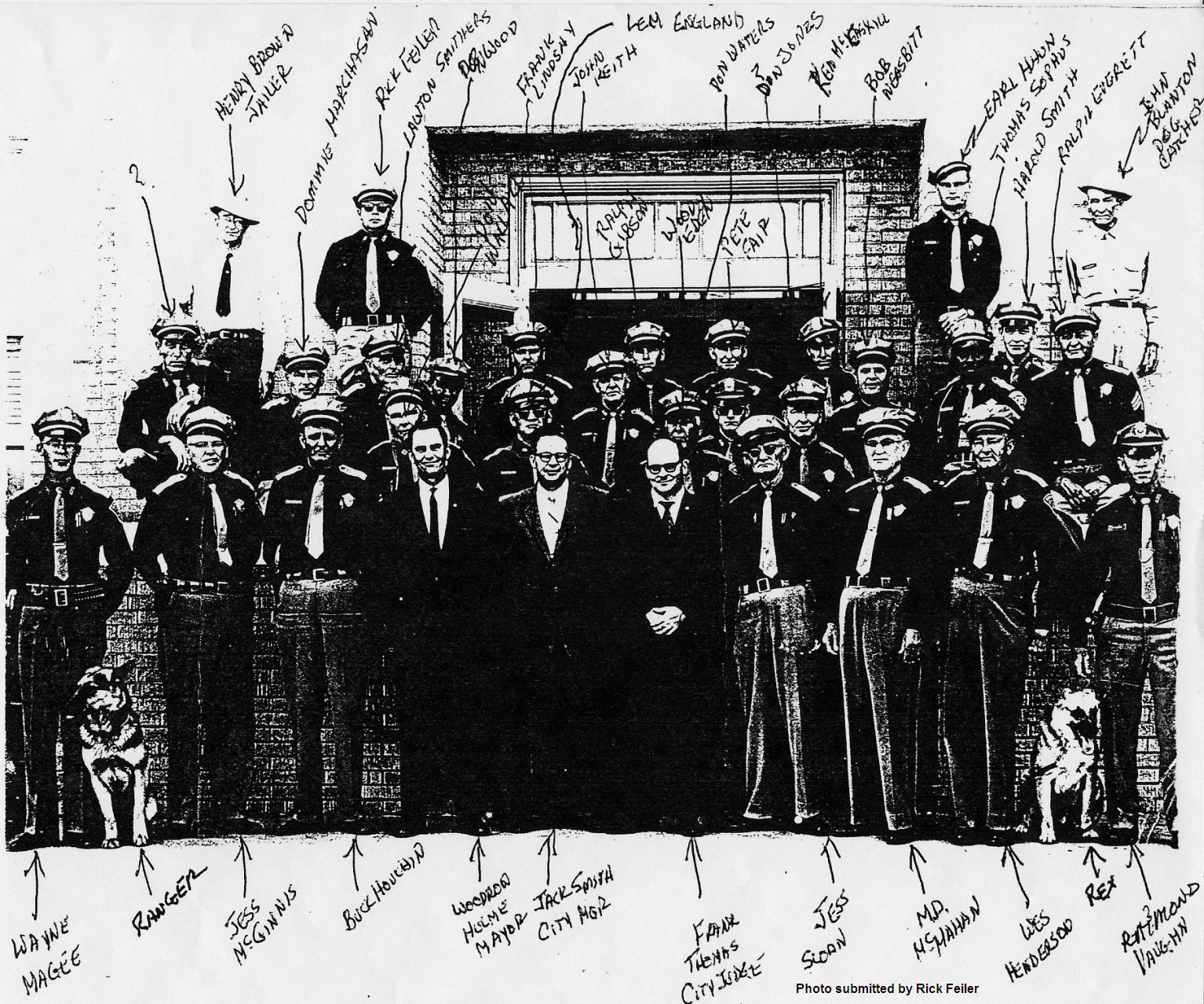
I have cleaned up 1 of the 3 Ardmore PD photos sent in my Rick Feiler last week. And Jim Hubbell at Whitesboro, Texas is working on the second photo as we speak. To see the cleaned up first photo, click on the first link below.
http://www.oklahomahistory.net/ttphotos9a/APD_Feiler_1959.jpg
http://www.oklahomahistory.net/ttphotos9a/APD_Feiler_1961.jpg
http://www.oklahomahistory.net/ttphotos9a/APD_Feiler_1969.jpg
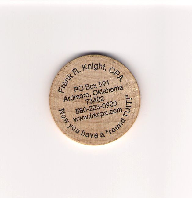
Rick Feiler brought by a another neat wooden nickel this week. Ardmore CPA Frank Knight had them made to go along with his CPA business and it being tax season, the timing was perfect. If you feel like you just can't live without one of these unique wooden nickels, get in touch with Frank and he might just give you one.
http://www.oklahomahistory.net/ttphotos9a/KnightTuitSideA.jpg
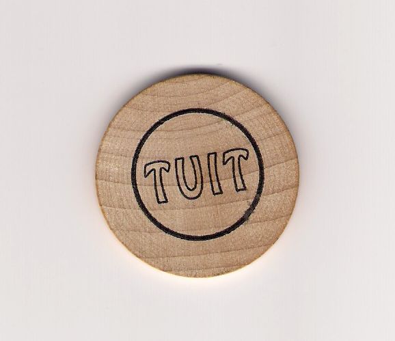
http://www.oklahomahistory.net/ttphotos9a/KnightTuitSideB.jpg
So, you've looked at the wooden nickel and ask, What is a round tuit?
Tuit: A tuit or round tuit is a unit of potential work. Its a play on the phrase "when I get around to it" transliterated into "when I get a round tuit".
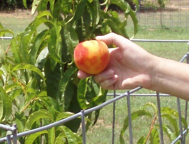
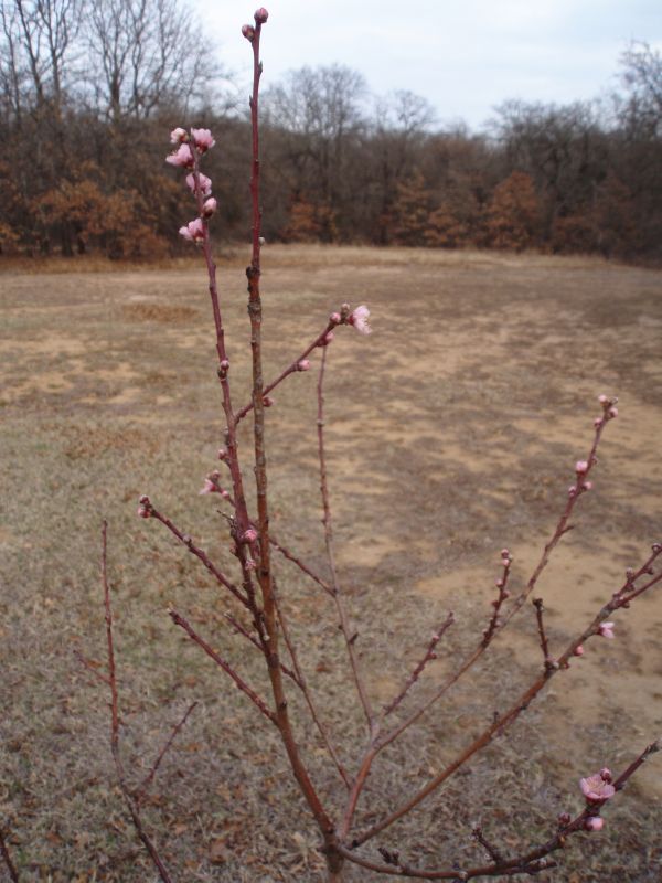
I noticed this week 3 of our 6 fruit trees have blooms on them. They are the peach trees, the pear and apricot trees have no blooms yet. Below is a couple pics I took of our Harvester Peach tree with blooms. This is the same tree that had a couple of very sweet Harvester peaches on it last July, and we had only planted 3 months before.
http://www.oklahomahistory.net/ttphotos9a/HarvesterPeach09a.jpg
http://www.oklahomahistory.net/ttphotos9a/HarvesterPeach09b.jpg
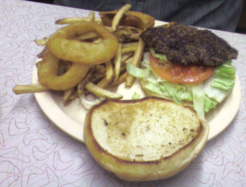
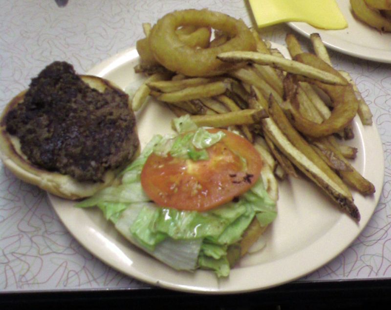
Larry Gilbert sent in a couple photos he took of a hamburger from the Highway 77 Grill in Davis, Oklahoma. I guess Jill and I will have to get up that way soon and try a burger from there. They close around 3pm, so a person can't wait until evening hours.
http://www.oklahomahistory.net/ttphotos9a/77GrillBurger09a.jpg
http://www.oklahomahistory.net/ttphotos9a/77GrillBurger09b.jpg
Ten cheapest places to buy gas in the Ardmore area......
http://www.oklahomahistory.net/gasprices.html
Oklahoma History Boards!
http://oklahomaroots.proboards83.com/
Q. Who were the Buffalo Soldiers?
A. African American troops organized after the Civil WarQ. Where did the Creek people live before their removal?
A. (answer in next week's T&T)Some mail from this week's MAILBAG.....
"I dug out my Santa Fe Time Table #2 for the Western Lines, Northern Division dated Sunday, April 27, 1975. I scanned it from front to back and uploaded all 20 pages to my webshots albums. The Ringling District is shown on page 14. Here's the link:" -Dwane Stevens
http://entertainment.webshots.com/album/569975222CFRTve
"Butch, I expect a lot of answers for that question about the Buffalo Soldiers are going to deal with the army company made up by black soldiers, (with white officers), but don't forget that the plains Indians called individual soldiers that first. Because of their color and hair." -Larry
"I've also had ladybugs EVERYWHERE here in SW Ardmore! Even now in mid-winter, I'm finding them by the hundreds in my closet. I have to check my shoes every time I put them on. They've been all over the house and in my ferns on the front porch, but for some reason, they like my closet the best."
The ladybugs eats aphids of all types, well save me typing can read about it here. http://en.wikipedia.org/wiki/Ladybug
"I also have a page up of pictures on the Lone Grove tornado. all Aerial." -Tony
http://k7iss.info/lonegrove/
"I got this from a friend of mine in Ardmore. Thought maybe you might be interested in it. Looks like there might be a couple more videos of the Lone Grove tornado."http://www.youtube.com/watch?v=-JHBWn3T1mE
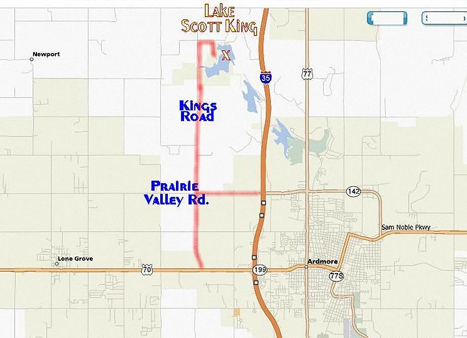
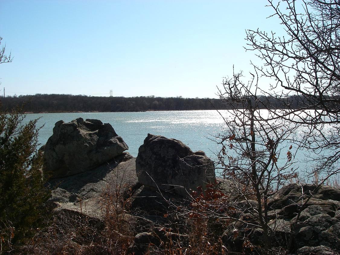
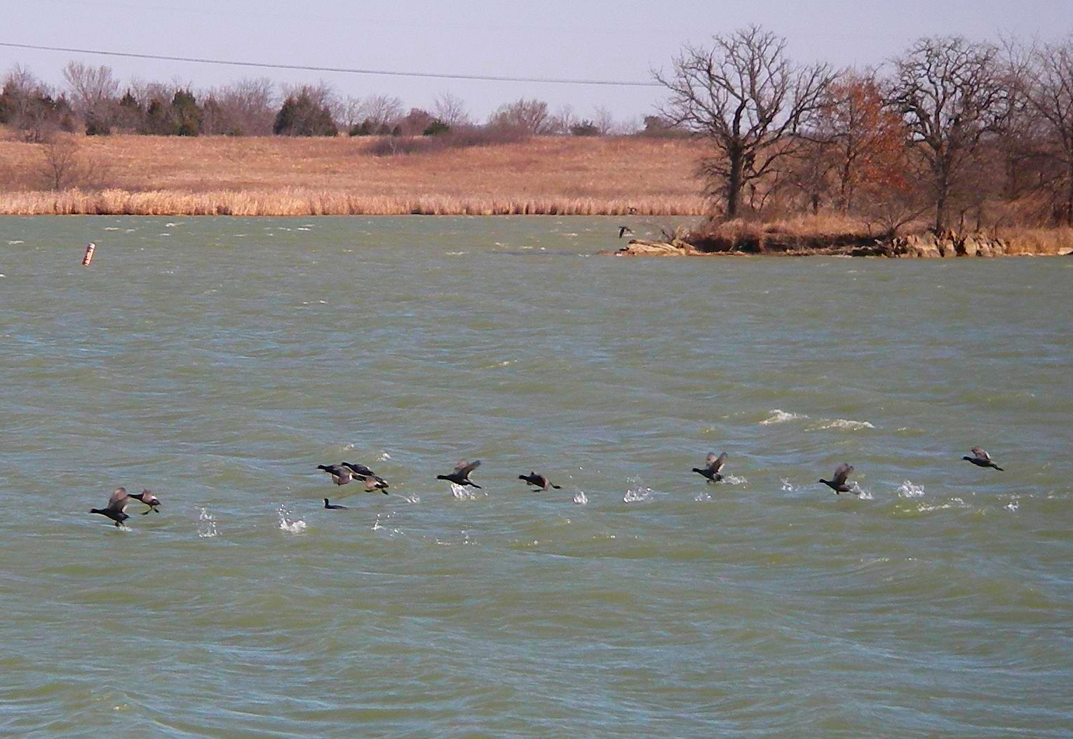
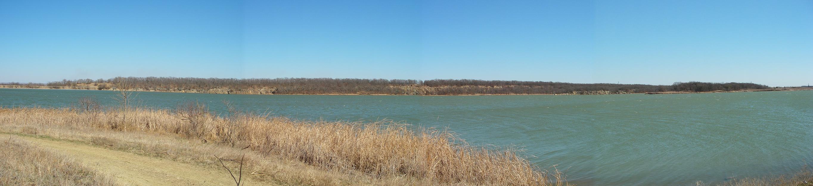
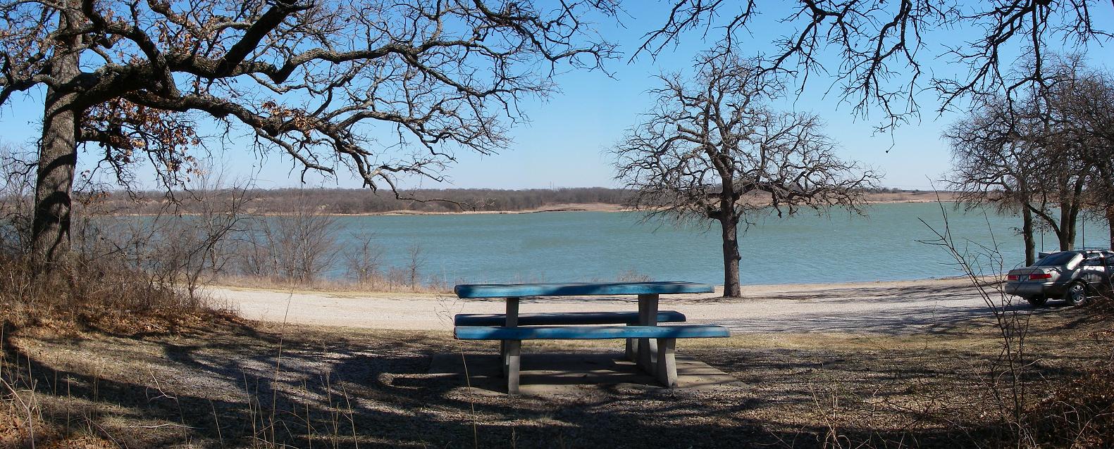
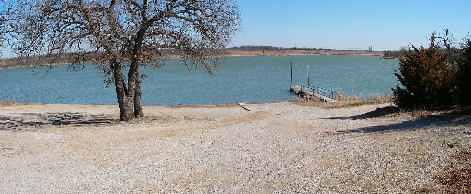
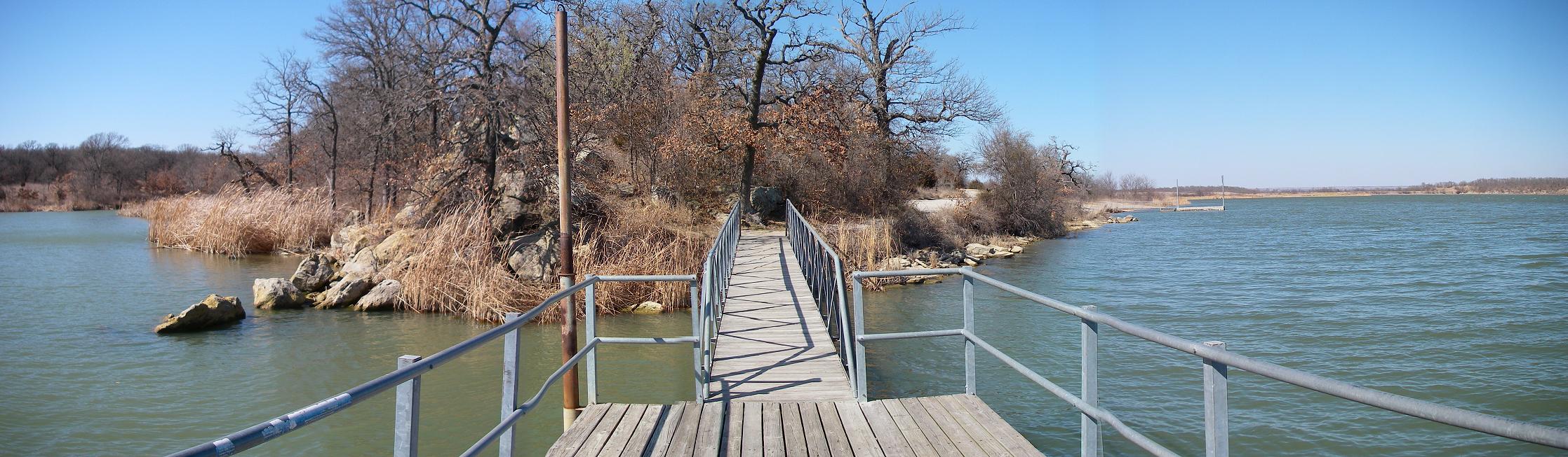
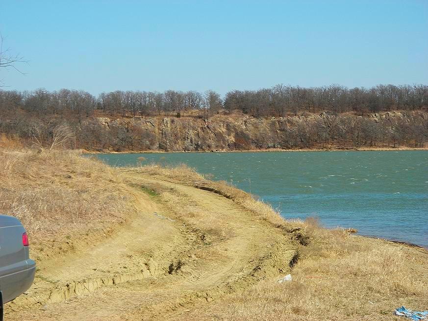
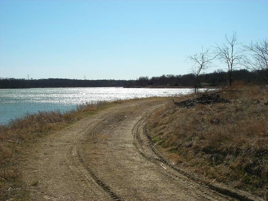
"Butch, I got bored sitting at home on this windy, cold, but sunny Saturday and went up to Lake Scott King to shoot a few photos. The lake is just about a mile north of my house so I go up quite often. If you haven't taken Jill up there yet then you need to plan a trip. It's such a pretty little lake and some people seem to do good with the fishing. It is an Ardmore City Lake (used to be called Lake Site #18 when we first moved up here) and requires a fishing permit from the City but picnicking and just enjoying the scenery is free. We have hiked across the Dam and down along the rock bluff on the far East side many times and the scenery from over there is fantastic. You can't drive across the Dam as in the past so the hike is a bit long from the closest parking but well worth it. There are no official trails over there, just animal trails, but it is so peaceful and scenic. Just take a bottle of water and some good hiking boots and enjoy. I've attached several photos including some pano shots and a shot of ducks taking flight from the water. They didn't appreciate me disturbing them for some reason! ha! I've also attached a map to the Lake. The map seems to indicate a short cut road from I-35 to the Lake but those are private roads with gates. From I-35 the shortest route is to take Prairie Valley Rd. (opposite Veterans Blvd. or 142) West two miles to Kings Rd. then north about 4 miles then East about 1/2 mile (watch for signs). From Hwy 70, 3 miles West of Ardmore take Kings Rd North about 6 miles then East about 1/2 mile. If any of your local newsletter readers haven't made the trip up there then they will be in for a pleasant surprise." -Dwane Stevenshttp://www.oklahomahistory.net/ttphotos9a/LakeScottKingMap.jpg
http://www.oklahomahistory.net/ttphotos9a/LakeScottKing022809a.jpg
http://www.oklahomahistory.net/ttphotos9a/LakeScottKing022809b.jpg
http://www.oklahomahistory.net/ttphotos9a/LakeScottKing022809c.jpg
http://www.oklahomahistory.net/ttphotos9a/LakeScottKing022809d.jpg
http://www.oklahomahistory.net/ttphotos9a/LakeScottKing022809e.jpg
http://www.oklahomahistory.net/ttphotos9a/LakeScottKing022809f.jpg
http://www.oklahomahistory.net/ttphotos9a/LakeScottKing022809g.jpg
http://www.oklahomahistory.net/ttphotos9a/LakeScottKing022809h.jpg
Auction Saturday, March 7, 2009 10:00 AM
HALVERSON RANCH DISPERSAL Pauls Valley, Oklahoma
Complete Dispersal of Farm Equipment/Machinery
DIRECTIONS: From The Intersection Of S.H. 19/133 (East Of Pauls Valley, OK) Travel North 3.2 Miles
OR From The Intersection Of S.H. 59/133 (West Of Byars, OK) Travel South 3.3 Miles. Auction East
Side Of Hwy. Watch For Signs. For Color Pictures & Complete Details:
http://www.berryauctions.com/March7_2009/March7_2009.html
World's most beautiful high resolution aerial photographyhttp://cessna-aerials.info/index2.html
"Butch, I was visiting my brother yesterday and he and I set out to find the old Smyrna school. The old foundations are located on the east side of the Dickson road between .25 and .50 miles north of highway 70."
The Daily Ardmoreite
9-12-1917
A STAR FOR EVERY STATE
Each Has Its Particular Place on the American Flag
Detroit Free Press: Did you know that every star in our American flag has its own individual and particular state which it represents and that its placement on the square of blue is carefully and definitely regulated by law and executive order? In 1912 on the 26th day of October the last executive order concerning the flag was made and it provided for the specific arrangement of the stars. They were to be arranged in six horizontal rows of eight, each starting in the upper left hand corner and forming each row from left to right with the star, representing each state, appearing in the order in which the state became part of the union.
First row - No. 1, Delaware; 2, Pennsylvania; 3, New Jersey; 4, Georgia; 5, Connecticut; 6, Massachusetts; 7, Maryland; 8, South Carolina
Second row - No. 9, New Hampshire; 10, Virginia; 11, New York; 12, North Carolina; 13, Rhode Island; 14, Vermont; 15, Kentucky; 16, Tennessee
Third row - No. 17, Ohio; 18, Louisiana; 19, Indiana; 20, Mississippi; 21, Illinois; 22, Alabama; 23, Maine; 24, Missouri
Fourth row - No. 25, Arkansas; 26, Michigan; 27, Florida; 28, Texas; 29, Iowa; 30, Wisconsin; 31, California; 32, Minnesota
Fifth row - No. 33, Oregon; 34, Kansas; 35, West Virginia; 36, Nevada; 37, Nebraska; 38, Colorado; 39, South Dakota; 40, North Dakota
Sixth row - No. 41, Montana; 42, Washington; 43, Idaho; 44, Wyoming; 45, Utah; 46, Oklahoma; 47, New Mexico; 48, Arizona
The Chickens
Said the first little chicken,
With a strange little squirm,
"I wish I could find
A fat little worm."
Said the next little chicken,
With an odd little shrug:
"I wish I could find
A fat little bug."
Said a third little chicken,
With a small sigh of grief,
"I wish I could find
A green little leaf!"
Said the fourth little chicken,
With a faint little moan,
"I wish I could find
A wee gravel stone."
"Now, see here!" said the mother,
From the green garden patch,
"If you want any breakfast,
Just come here and scratch!"
See everyone next week!Butch and Jill Bridges
http://www.OklahomaHistory.net
Nashobish Ikana
PO Box 11
Ardmore, Oklahoma 73402Save on long distance calls, just a couple cents a minute!
http://www.CheapLongDistance.org
Oklahoma Bells: http://www.OklahomaHistory.net/bellpage.html
American Flyers Memorial Fund - Administration Webpage
http://www.OklahomaHistory.net/crash66.html
Official American Flyers Memorial Website
http://www.brightok.net/~wwwafm
Ardmore Army Air Field/Ardmore Air Force Base Website
http://www.brightok.net/~gsimmons
Mirror Site of the Ardmore Army Air Field/Ardmore Air Force Website
http://www.OklahomaHistory.net/airbase/
Carter county schools, past and present
http://community.webshots.com/user/oklahomahistory
Carter County Government Website
http://www.brightok.net/cartercounty/
All previous issues of This & That can be found on my Website.
Feel free to forward this free newsletter. Mailouts: over 1,600.
To be removed from my T&T mailings, just send me an email.
I do not sell, trade or give my mailing list to anyone for any reason.